New Hampshires 48 4,000-Footers: One Step at a Time
Hiking NH 48 4,000 footers one step at a time
Are we going to hike all 48 of New Hampshire’s 4,000-footers? I don’t know. But we’re going to try our best—one step & one snack break at a time.
This is an ongoing blog I’ll update as we check each NH 4,000-footer off the list. Take our advice or simply learn from our mildly chaotic journey as a couple of enthusiastic, slightly underprepared, outdoors-loving 40-somethings. We’re just trying to trade couch time for trail time—and hey, the views definitely beat doom scrolling the day away!

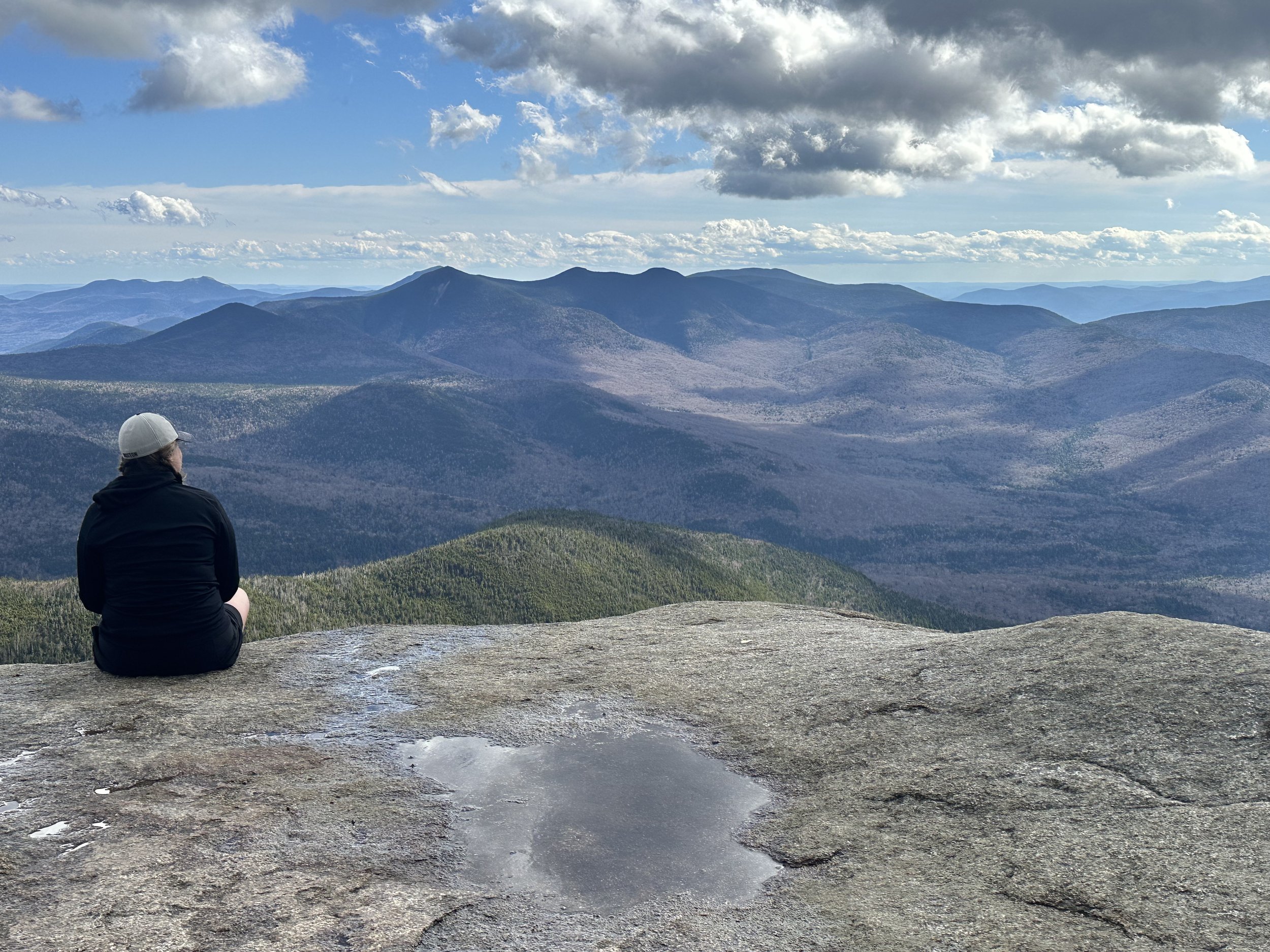
Mount Osceola peak
Mount Osceola
#1 of 48: You gotta start somewhere!
We only hiked one of the two peaks here—so does it count? Yes. Yes, it absolutely does. Let me explain.
What do I mean by “one of the two”? Well, Osceola has a buddy: East Osceola. They’re often hiked together as a dynamic duo. But since this was our first “big” hike, we decided to ease into it with just one summit. Baby steps, folks. You can read our thought process (and trail logic) in more detail [here]
And yes, we fully realize that if we want to earn that shiny “48” badge, we’ll have to come back and hike it again. But honestly? Worth it. This mountain was a total gem. In my non-expert, mildly sore opinion, it was the perfect introduction to the 4,000-footer club.
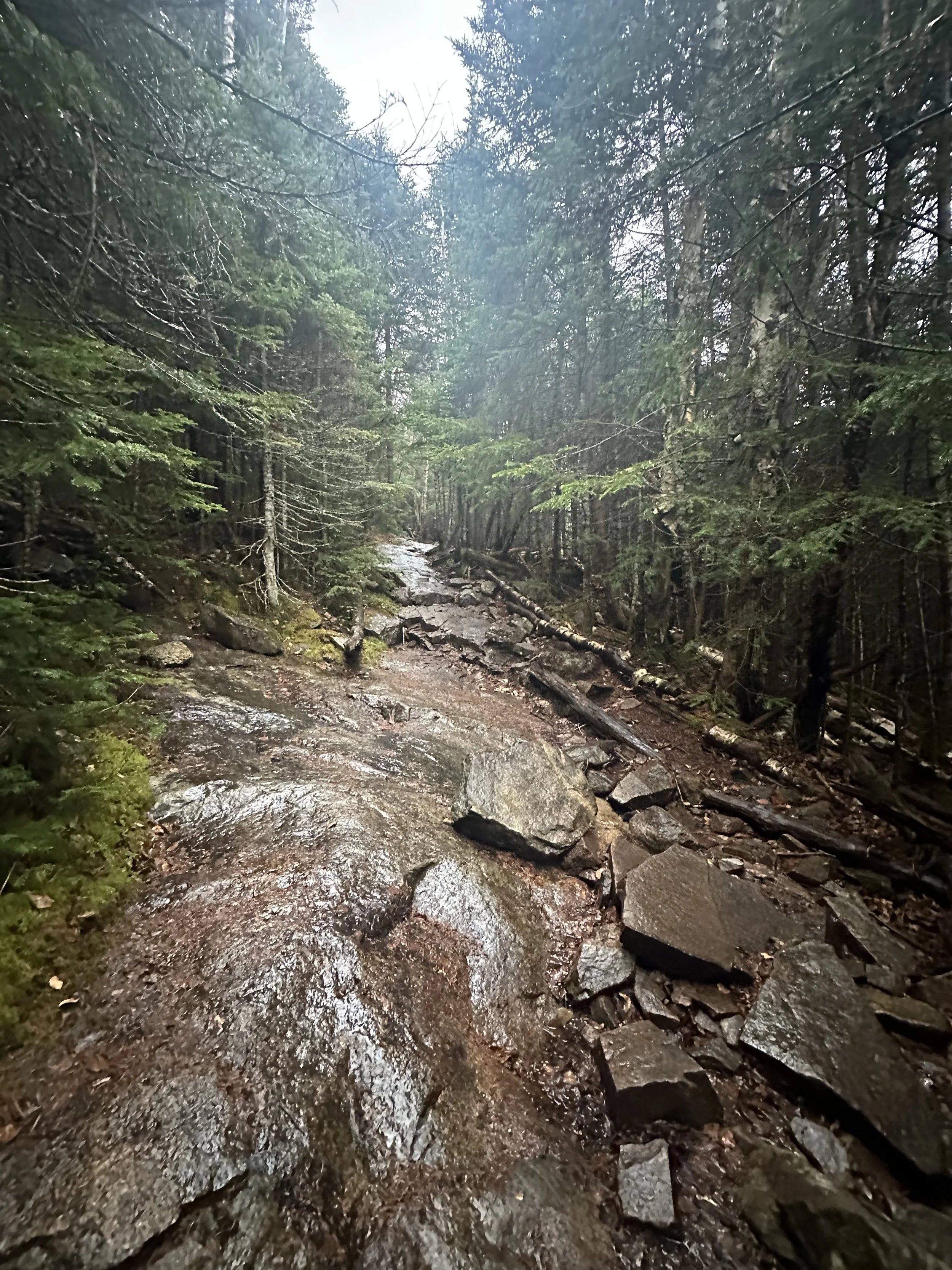
We hiked from Tripoli Road on a cool, rainy morning. The trail—though not marked well—was very easy to follow. It’s full of rocks to step over, but there were no scrambles or major climbs. Near the summit, there are some slanted rock slabs to navigate. Trust me when I say it’s best to walk on the awkward spot close to the ground. (You can listen to me explain why on our podcast episode [here].)
The views from the top were absolutely gorgeous. We could see the Waterville Valley ski area among the surrounding mountains.


This was a magical mountain for us to climb, and if you’re looking for a beginner-friendly 4,000-footer, this one should definitely be on your list!
Stats:
Elevation: 4,340 feet
Elevation gain: 2,040 feet
Distance: 6.4 miles round trip
Views: 10/10
Difficulty: 7/10

From the summit of Mount Pierce.
Mount Pierce
#2 of 48: One Step Closer!
We tackled this one toward the end of winter—aka that fun time of year in New Hampshire when it’s sunny in the parking lot but feels like Everest at the summit.
Microspikes were a must from start to finish, but snowshoes? Not even close. The snow on the trail was packed into a narrow monorail path, and stepping off it meant immediate regret (and post-holing up to your kneecaps). At one point, I casually sank my hiking pole all the way to the handle just a few inches off the trail. That was enough science for one day.
Mount Pierce was our first adventure into the Presidential Range, which felt pretty epic for our second 4,000-footer. We started at the AMC Highland Center, which has a big, easy-to-find parking lot. Just cross the street and boom—you’re at the trailhead for the Crawford Path.
This trail comes with serious historical street cred. It was first cut in 1819, making it the oldest continuously used mountain trail in the U.S. The Crawford family created it from their homestead (now Crawford Notch) to the summit of Mount Washington. Imagine deciding to cut a trail to the highest point in the Northeast—just because you could.


The hike starts climbing pretty quickly and doesn’t let up much. About 0.6 miles in, you get to see the very lovely Gibbs Falls, and the trail follows a river for a bit before breaking off. Roughly 0.7 miles from the summit, there’s a trail to the AMC Mizpah Spring Hut, which is closed in winter, so we stayed on Crawford Path. That side trail does loop around to the summit if you’re feeling extra ambitious in warmer months.
As you near the top, the trees start to thin, and suddenly—you’re in the Alpine Zone. There’s even a bench (yes, a bench!) where you can take in stunning views of Bretton Woods, the Mount Washington Hotel, and the looming beauty of Mount Eisenhower and Mount Washington right in front of you.
And then... in classic White Mountain fashion, the weather pulled a fast one. We felt a breeze entering the Alpine Zone, but by the time we reached the true summit just a few hundred feet later, the wind had cranked up and the cold rolled in like it had an appointment. So, instead of a scenic summit lunch, we hightailed it back to the tree line and picnicked there. Slightly less epic—but significantly warmer.
This hike was a blast. It was easier than we expected (thanks, packed trail!), and the views were absolutely top-tier. We’re officially hooked on the Presidential Range and can’t wait to check more off the list.
Stats:
Elevation: 4,310 feet
Elevation gain: 2,400 feet
Distance: 5.9 miles round trip
Views: 10/10
Difficulty: 6/10

Canadian Jay is eyeing our lunch with Mount Washington in the background.
Mount Jackson
#3 of 48: Jays, Ice, and Jaw-Dropping Views
This one had a little bit of everything: icy trails, sweeping views, and feathered trail companions that got very comfortable with us.
The hike starts out across from the Crawford Notch train station. We parked by the lake which is near the trailhead. We were very grateful to have our spikes as the trail was solid ice in places and packed snow in others. Snowshoes weren’t necessary (thankfully), but any step off the main path was instant regret. Classic monorail conditions. We were very glad we had our poles as well!
The trail itself wastes no time. It climbs steadily through the woods and throws in a few steeper sections just to keep things interesting. We didn’t hit anything technical, but the consistent ice made things a little more mentally taxing than usual. Near the top, the trail opens up to some rock slabs—this is the one area where we ditched the spikes for better grip. From there, it’s just a short, breezy push to the summit. And what a summit it is.
We were lucky enough to get a clear day, and the views of the Presidential Range were magical. Similar to Mount Pierce, this vantage point made Mount Washington look massive and snowy in the distance, and the surrounding peaks felt close enough to touch. Definitely one of those “whoa, this is why we hike” moments. As an added bonus, we even remembered to bring and use our binoculars!
The Canadian jays were something else! These bold little guys popped out just before the summit and were more than happy to hang out for a while. They were quite attentive and aggressive when we ate our peanut butter and jelly sandwiches!


If you want to hear us talk more about the trail conditions, our bird encounters, and our exciting ending to the hike, you can listen to the Mount Jackson episode.
All in all, Mount Jackson was a gem. In our completely non-expert, but slightly more confident opinion, this was one of the more rewarding hikes we’ve done so far. If you’re working on the 48, don’t sleep on this one. We’ll gladly come back for a summer version someday—but even with the ice, we’d do it all over again.
Stats:
Elevation: 4,052 feet
Elevation gain: ~2,150 feet
Distance: 5.2 miles round trip
Views: 10/10
Difficulty: 7/10

The Sandwich Range from The Boneyard ski trail at Waterville Valley on Mount Tecumseh
Mount Tecumseh
#4 of 48: Shortest 4,000 footer but a Straight Up Beast (SUB)
If you are looking for a 4,000 footer that won’t destroy your knees or your weekend plans, this hike is for you! The trailhead starts in the parking lot of the Waterville Valley ski area. Although this mountain is still listed as one of the 48 4,000 footers, it technically is a few feet lower than 4,000 feet when measured using more advanced LIDAR (Laser Imaging, Detection and Ranging) technology in 2019. The Mt Tecumseh Trail trailhead starts in the parking lot of the Waterville Valley ski area. There are no bathrooms available but the parking is free from the ski area. There is another trail that starts off Tripoli Road that is longer, and less steep, but we did the steeper Mt Tecumseh Trail.
The trail follows the edge of the ski area most of the way up to the summit. There are two spots on the trail that peek out to the ski trails. Take the moment to walk over and enjoy the views of Waterville Valley from the trail. The views at the true summit of Tecumseh aren’t great. The trees block any 360 degree views. There is an option to go over to the ski area summit via the .5 mile Sosman Trail. We didn’t venture off for that, but it is an option and the views are much better from the ski area. The views include the Osceola and East Osceola, and the Sandwich range.


Just because this mountain is short, doesn’t mean it’s easy, but it is certainly doable! The trail is mostly a steady incline - no huge scrambles or exposed ledges. You’ll gain elevation pretty consistently, there are a few rocky sections, but there are about a million stone stairs! The trail is very well maintained and even though its mostly tree covered, it was very peaceful. This is a good hike for your dogs too!
Mount Tecumseh might be the shortest of the 48, but it was not super easy. It’s a great confidence building hike. Whether you are are just starting your journey, or looking to squeeze in a hike before lunch, this “little” mountain delivers big satisfaction!
Stats:
Elevation: 4,003* feet
Elevation gain: ~2,150 feet
Distance: 5.0 miles round trip
Views: 6/10
Difficulty: 7/10

We hiked a 4,000 footer!!
What we thought was the best 4,000 foot mountain to hike fist.
We Conquered Our First 4,000-Foot Mountain!! 🎉
I’ll admit it—this one got me a little emotional. It wasn’t that it was the most challenging hike, but it was our first 4k. We always said we weren’t sure if we’d be into the 4,000-footers list, but suffice it to say… we’re hooked. Guess we’ve got a new obsession on our hands!

Click Photo To Listen to Podcast!
Mount Osceola Stats:
Distance: 5.7 miles round trip
Elevation Gain: 2,040 feet
Scramble/Climbing: Nope, no rock climbing here—just good old-fashioned hiking!
We parked off Tripoli Road in Waterville Valley. A heads-up: this road can be closed during the off-season, so always check the status of trail and road closures before you head out. Also, Tripoli Road is basically a rugged rollercoaster ride for your car, so watch out for potholes that could double as small craters. There's a small, cash-only parking fee. The good news? There’s a bathroom. Which, when you're out in the wilderness, feels like winning the lottery.
The trail itself isn’t exactly marked—at least, not that we could find. But it’s pretty straightforward and starts right off the parking lot. Of course, it was raining when we began, which definitely had us second-guessing our decision to hike a mountain. But, hey, what’s a little rain, right?
Click Photo to Listen to Podcast!
The rain let up as we hiked on, and the trail? Gorgeous. The incline was gradual (thankfully). The trail is made up of mostly rocks, not so much the climbing kind but to be careful of as you’re hiking on. As we got closer to the summit, the views started to peek through the trees—though, if the clouds had parted, I bet it would’ve been even more epic. I could catch glimpses of Waterville Valley’s ski trails and other mountain peaks trying to sneak their way into view.


Getting closer to the top, we hit one major muddy spot and a rock that was a bit too slanty and slippery for comfort, thanks to the morning’s rain. But it wasn’t anything we couldn’t handle. The whole hike took us about 3.5 hours—though I should mention that I'm super slow, especially on the uphill sections. My cardio could use some work! But honestly, just being out in nature made the slow pace totally worth it.

Click Photo to Listen to Podcast!
Once we hit the peak, we had the option to keep going and summit East Osceola, which would have meant conquering two of the 48 4k-footers. But we decided to call it a day while we were ahead. I was feeling good, and didn’t want another Mt Chocorua day (Listen to that episode here) and the views were incredible. We hung out for a while, soaking it all in. Through the trees, we could see Waterville Valley, and I swear I caught a glimpse of Mount Chocorua peeking through the clouds.

Click Photo to Listen to Podcast!
All in all, it was a perfect first 4k. I’ve never hiked any other 4,000-footers, so I can't really compare, but I think Osceola was the perfect place to start. The incline was manageable, and the views were out of this world. It felt a little easier than Chocorua (though, let’s be honest, that’s not saying much), but it wasn’t a walk in the park either. Just the right balance for a 4k newbie.


Final Thoughts:
Views on top: 10/10 🌄
Difficulty: 7/10 🥵
Happy hiking, everyone! And remember, it’s not about the height of the mountain—just the memories you make along the way!