Waterfalls Around NH
We have been busy exploring NH’s waterfalls. There are a lot more to discover but you have to start somewhere. We will add them as we discover them, let us know if there are any others you’d like us to cover.
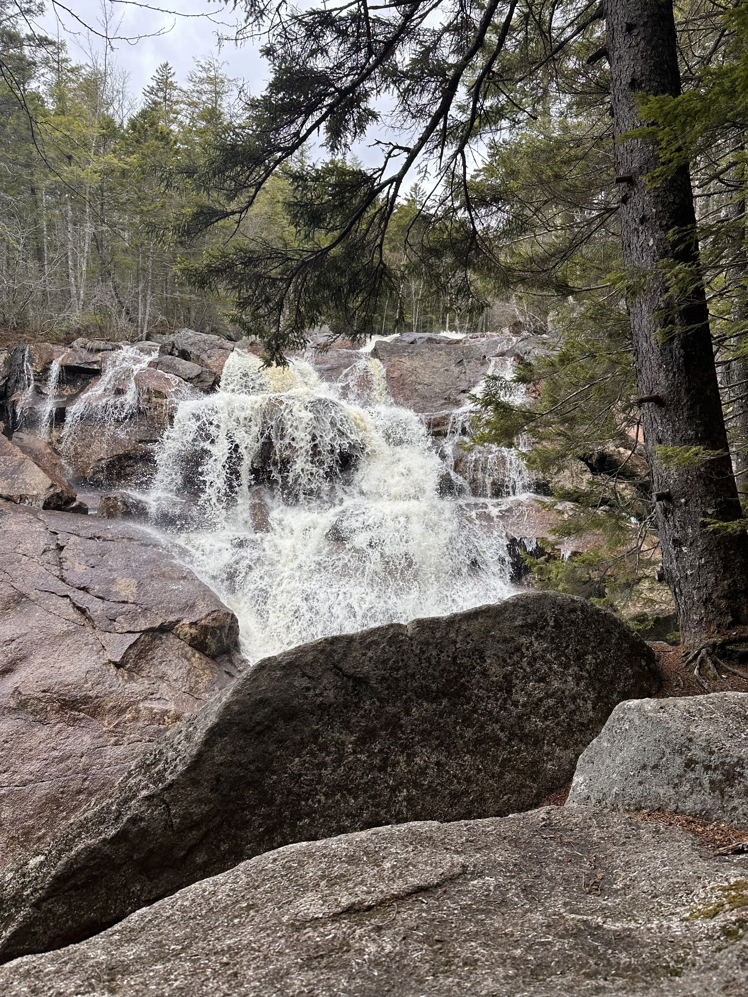
Walter/Newton Natural Area in Plymouth
1.6 mile loop easy/ family friendly
125 feet elevation gain
Small parking lot - free
No bathrooms
Dog friendly
Hike clockwise for the easy part first, could do this out and back for a real easy hike. It gets a little more challenging as you pass the waterfall & feels more like a hike rather than a walk in the woods like the first part, but nothing really hard. This hike is a hidden gem!! They have benches at the waterfall to stop and rest
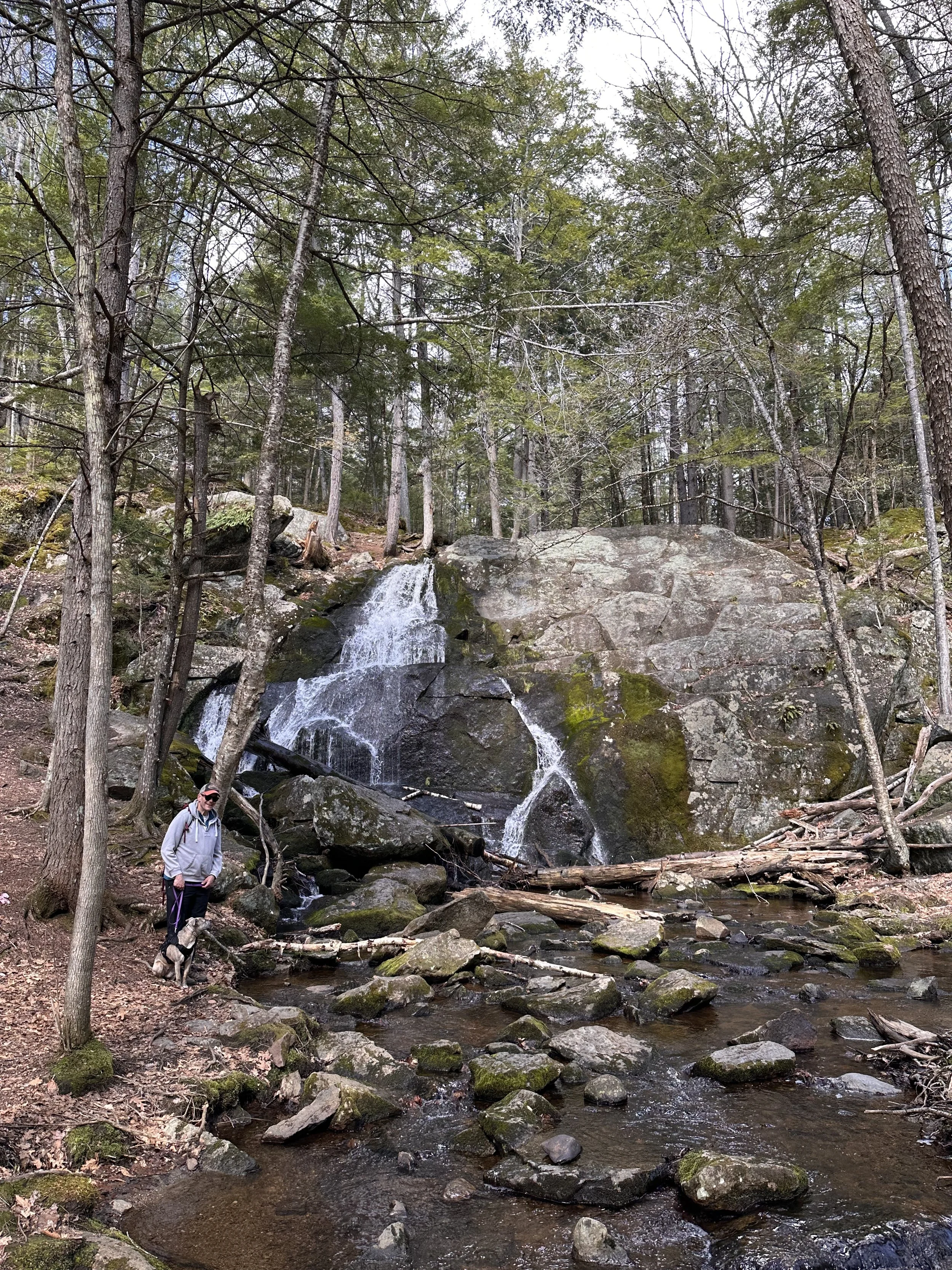
Walter/Newton Natural Area
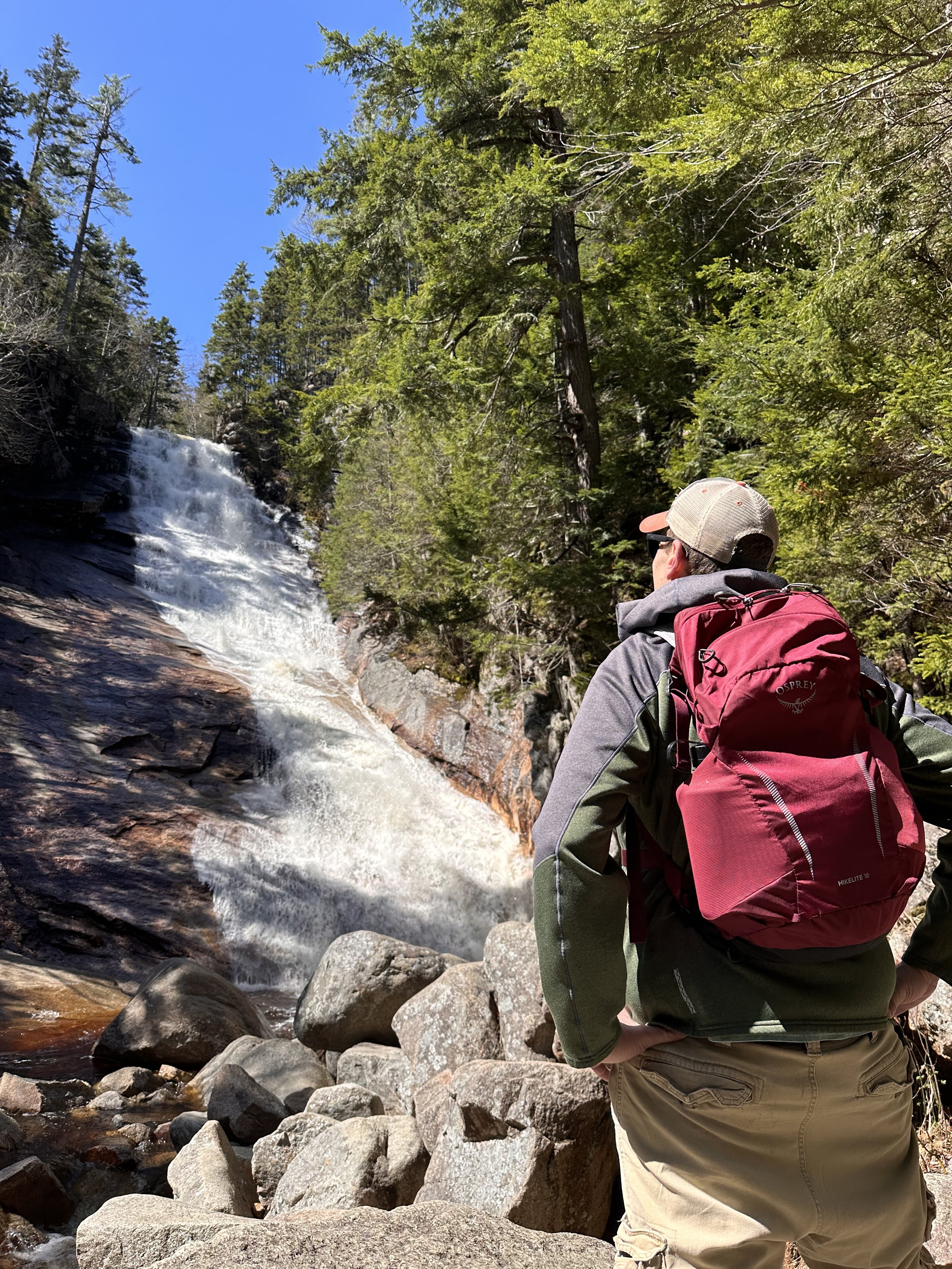
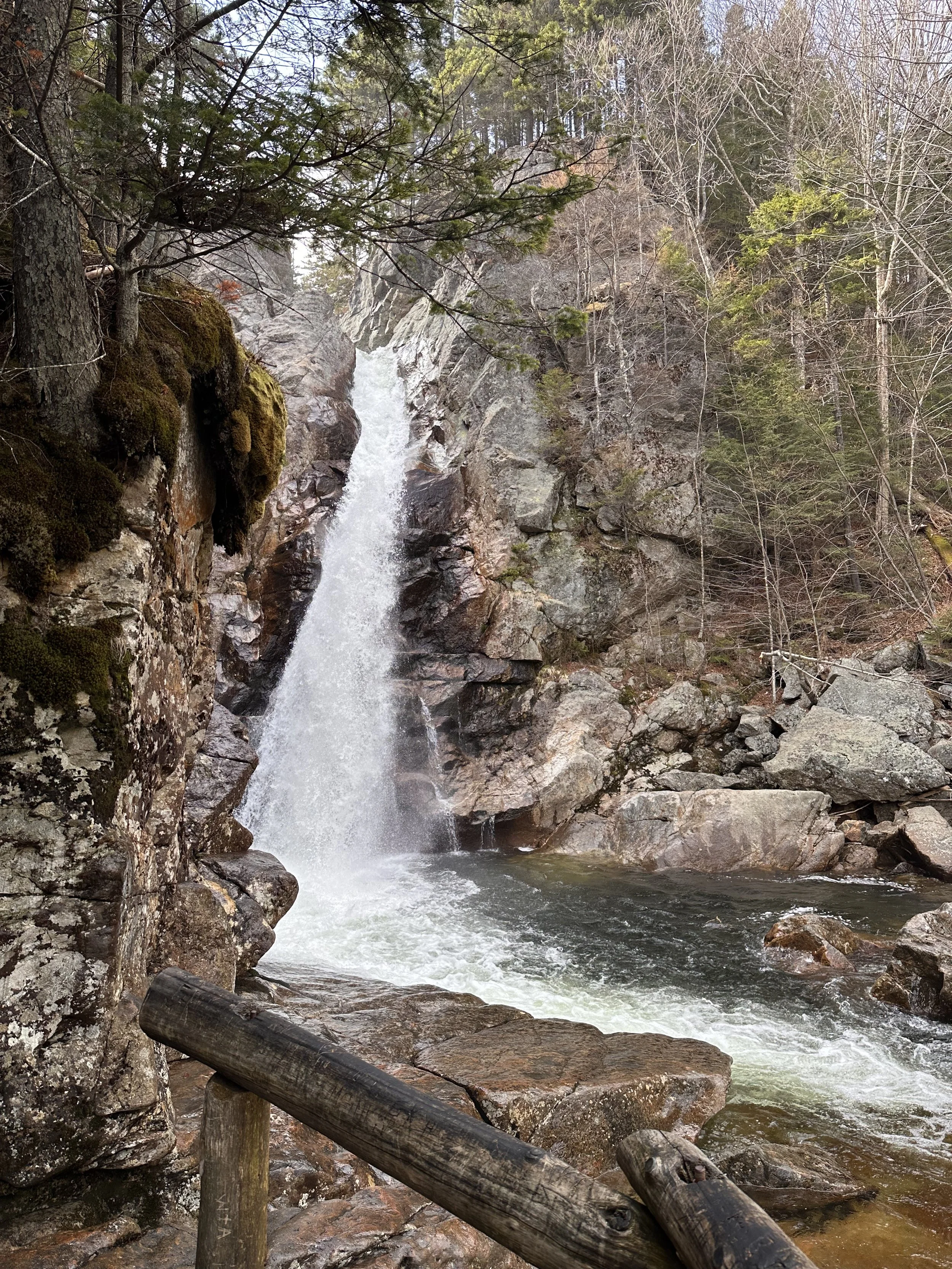
Bridesmaids Falls in Franconia Notch
1.1 mile total out & back
150 feet elevation gain
Very limited parking
Moderate/Some steep spots
No bathrooms
Dog friendly
Follow the GPS to the trailhead, there are no signs here. It is located in the Mittersill resort neighborhood by Cannon Mountain. The trail has blue blazes, sometimes blue and yellow sometimes blue and green. The trail can be narrow and single file most of the way.
Pro Tip: Push past the last water crossing for the best views.
Bridesmaid Falls Franconia Notch, NH
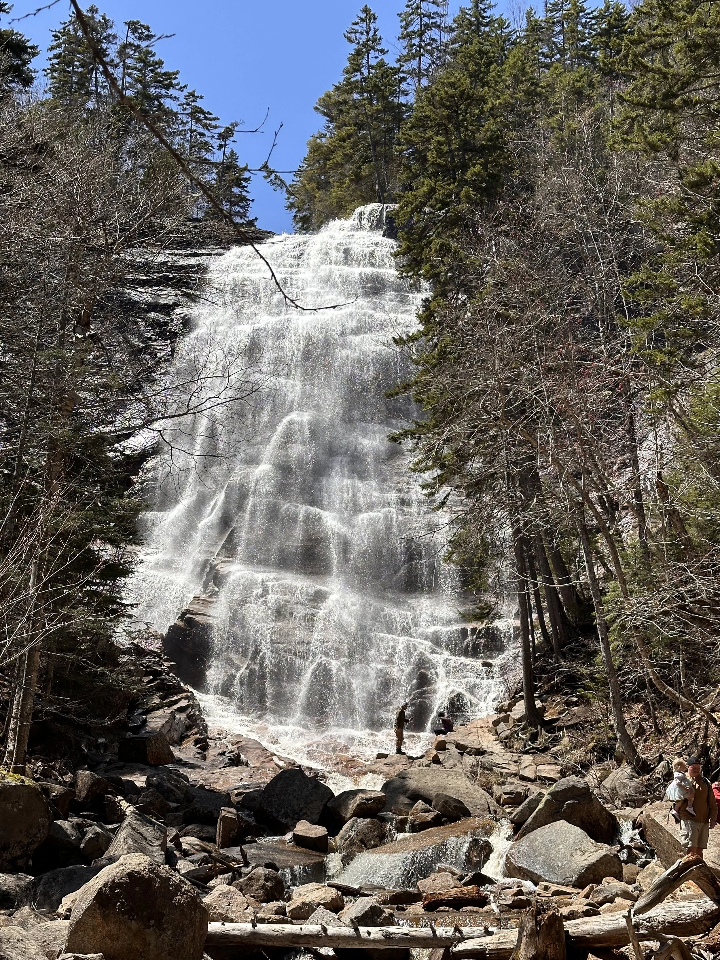
Georgiana Falls & Harvard Falls in North Woodstock
2.5 mile total out and back
More challenging/ advanced family friendly due to the steepness and lack of signage
Over 700 feet elevation gain
Parking is a small lot at the end of Hansen Farm road off route 3.
No bathrooms
Dog friendly (for an experience dog)
Start the hike around the fence, there are signs here and most of the trail will have red blazes. Not always easy to find the trail marking. Follow the Harvard Brook for most of the trail, it is beautiful. You will want to stop and take pictures for this entire hike. You get to lower Harvard falls first and then Upper Harvard Falls. The trail goes beyond the Upper Falls Trails, but we didn’t venture pass this part because of the dog, it looked tricky for her to be able to handle.
Lower Harvard Falls
Glen Ellis Falls Gorham NH
Located close to the Pinkham Notch visitor center.
Under 1 mile total out and back easy/ very family friendly all ages
130 feet elevation gain
Steps & handrails.
Charge to park -on season
Bathrooms at trailhead- on season
Dog Friendly
From the parking lot follow the trail under rt 16. The trail is crushed stone and then more of a stone path. You can have two options to view the 64 foot waterfall the upper and lower level. This is a run off from Ellis Falls from Mt Washington!
Glen Ellis Falls
Arethusa Falls Crawford Notch
Tallest waterfall in NH at 160 feet
Moderate hike
Bathroom at trailhead on season
2.8 Miles mostly out and back
885 feet of elevation gain
Dog Friendly
There are two parking lots here the lower lot if bigger and will give you a good way to warm up to the hike as it is at the bottom of the hill. You can take a little side trek on the way up to Arethusa Falls to see Bemis Falls. I suggest doing this way first as it is steep and going down this way (lesson learned by us) was a little tricky.
Pro Tip: hike in the spring after some rainy days
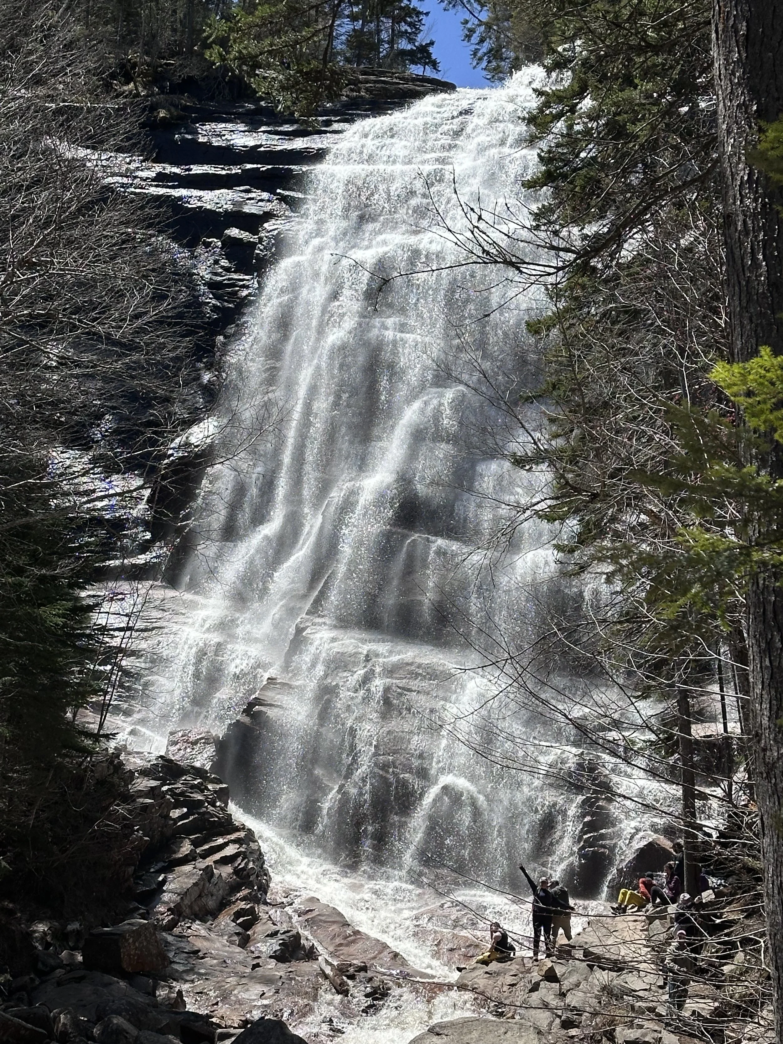
Arethusa Falls (me in the lower right corner I am 5’9” for scale reference)
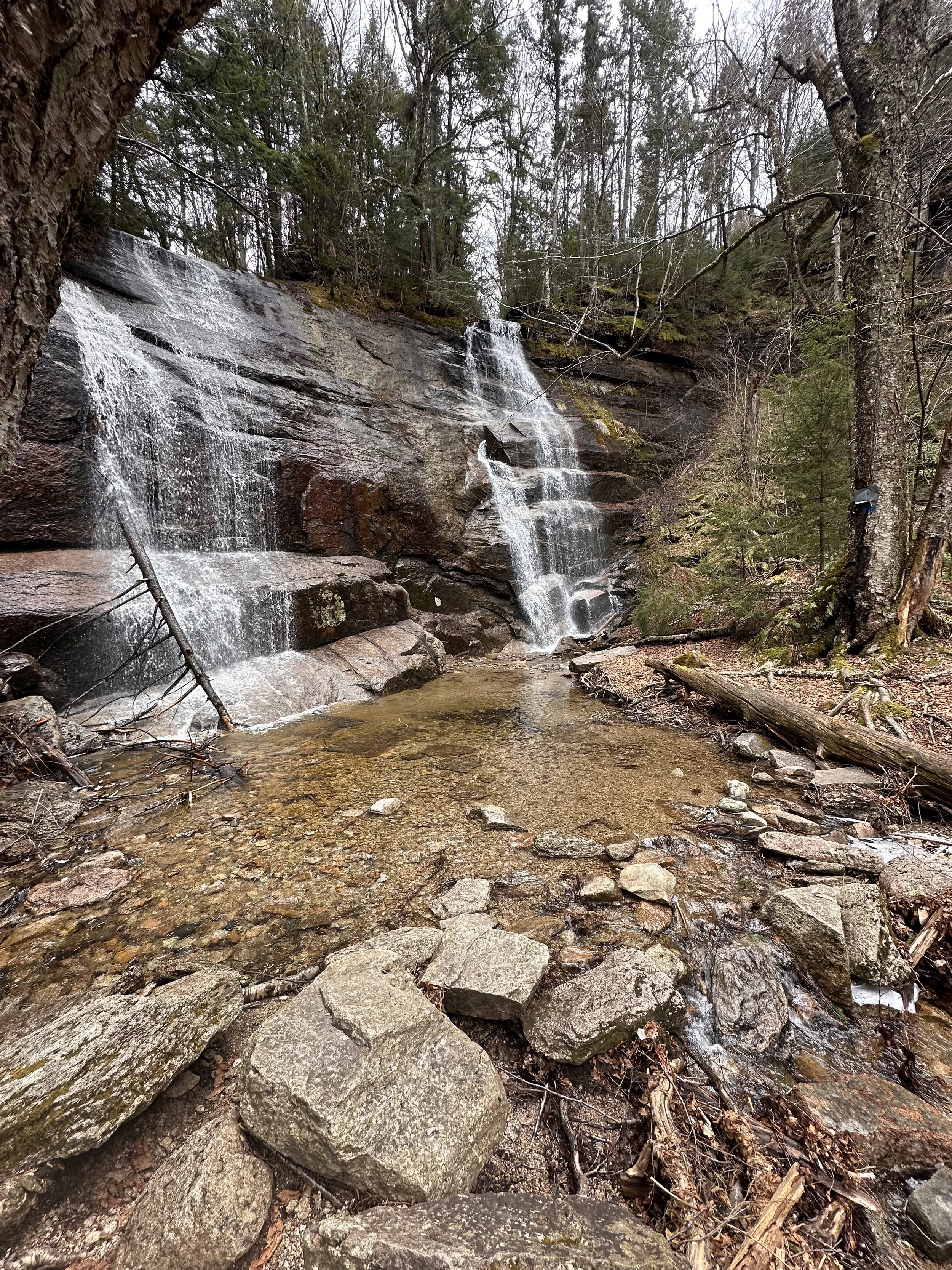
Ripley Falls Crawford Notch
1 mile
Coincides with the Appalachian trail
No bathroom here
Easy/ moderate Family Friendly
Dog Friendly
308 feet of elevation gain
Start the hike by crossing the train tracks. Easy to follow path with some steep sections, nothing too challenging. Great short hike to do with the family can easily do on the same day as Arethusa Falls or together.
Ripley Falls

Mount Monadnock
I finally hiked the popular Mount Monadnock and it did not disappoint!

If you’ve spent any time hiking in New England, chances are someone’s told you to check out Mount Monadnock. Maybe they even said it’s one of the most climbed mountain in the U.S. Regardless, I finally checked it off my list on an unseasonably warm Thursday in April—and wow, what a day for it.

Bluebird skies. No ice. No spikes. And most importantly, no regrets.
I opted for the classic route up the White Dot Trail and came down via the White Cross Trail, which I’d recommend if you’re not into testing your ankle stability on the descent.
Here are some stats:
The loop that I did was 3.9 miles with 1772 feet of elevation gain. The mountain’s elevation is 3245’ with 360 degree views.

White Dot is a bit of a cardio challenge, with some solid scrambles toward the top. Let’s just say there were a few spots that required more than just my dignity—I needed my hands too. I have yet to figure out a good way to attach the poles I use to my day pack so they were kind of in the way for a lot of the steep scrambles on the ascent. My knees thanked me for having them on the trip down!
That said, it’s absolutely doable for most people with determination (and snacks). I saw several kids under 8 hiking with their parents—some of them crushing it, others loudly voicing their discontent about “too many rocks.” I chuckle whenever I hear a child voicing what my inner mind wants to say out loud on the trail.


The summit views were spectacular—clear skies all the way into Massachusetts, Vermont and the White Mountains of New Hampshire. It’s one of those rare days in April where you feel like you’ve cheated the system. No snow, no ice or clouds and just enough of a breeze to cool you down at the summit.
A few things to note:
There is an entrance fee of $15 per car (6 passenger max) but the New Hampshire State Parks license plate gets you in for free. There are nice facilities here so it’s worth the money.
Reservations are strongly recommended as this trailhead gets busy. I’m glad I had a reservation.
It was surprisingly busy for a Thursday. That could have been because it was school vacation week in Massachusetts, and Monadnock is close enough to the border to draw a crowd.
If you’re choosing between White Dot and White Cross for your descent, go with White Cross. It’s more of a rock-hop than a scramble, and your knees will thank you later.
Bring plenty of water, wear decent shoes, and mentally prepare for the fact that this “easy mountain” is actually kind of a beast. In a good way.
Bring bug spray & sunscreen, especially as these warm spring days become more frequent.
There is a cute store at the trailhead that sells Monadnock State Park merchandise, drinks, stickers, and snacks!
The bathrooms are very nice with real plumbing!

Mount Monadnock lives up to the hype—but don’t let its popularity fool you into thinking it’s a walk in the park. It’s a rocky, scrambly, gorgeous New England classic, and you’ll earn every step of those views.

North & South Mountain Loop - Pawtuckaway State Park
North and South Mountain Loop - Pawtuckaway State Park, Nottingham, NH.
I woke up to a beautiful sunny spring day. My first thought was I need to get out for a hike today! Then reality of responsibilities set in, my limited time narrowed down my options considerably. I decided to check out a loop that’s been on our radar for a while—the North and South Mountain Loop at Pawtuckaway State Park in New Hampshire. Tucked away in the small town of Nottingham, this park is better known for its boulder field (a favorite among rock climbers), but the double summit loop turned out to be a surprisingly solid hike—more elevation than expected and some fun features that made it worth the effort.

Conditions in Late March
I lucked out with weather—temps in the upper 40s and no snow or ice on the trail, which meant no need for microspikes. Just dry leaves, the occasional mud patch, and that early-spring forest smell that hints at what’s coming.
If you’re itching to get outside before the higher peaks are fully melted out, this one’s a great shoulder-season option. It was about 15 minutes off route 101 in Nottingham, so it is pretty easy to get to from either 95 or 93.

The Hike
I did the full North and South Mountain Loop, a 6.9 mile loop with over 1300 feet of elevation gain. I started from the main trailhead and headed toward North Mountain first. That’s where I realized—this hike packs a little more vertical than it lets on. Going clockwise from the parking lot on Reservation Road, your incline starts rather quickly. The views are great from up there, and you can see two ponds in the distance. About halfway from North mountain to South Mountain, you walk between the ponds, pass the boulder field, and there are a few easy water crossings that connect the two ponds. I saw a Blue Heron and a few ducks in the pond. I felt like if I waited long enough, I would see a deer or moose come to the edge of the water for a drink but I just kept hiking.
The South Mountain summit features a fire tower, which technically offers 360-degree views. I have to take the internet’s word for it. By now it’s no secret I don’t do well with fire towers. I only made it up one flight of stairs—those things always feel sketchier than they look—but even from there, the view out across the bare trees was worth a stop. Definitely a good snack break spot if the summit is windy.
Not hard, but enough to make you feel like you’re in the mountains.

Lunch With a View
I had a quick lunch at the cairn on North Mountain, which looks like a stone throne—and yes, I absolutely sat in it like the King of Pawtuckaway. It’s a quirky little spot and a great place to soak in the moment before heading back down. Honestly, I was pretty tired by now and sitting in the sun for a few minutes felt great!
The descent was mellow, and I looped back toward the trailhead. The last mile or so is simply a walk in the woods. By now I had ran into another set of hikers and several mountain bikers. I also saw horse shoe tracks, so be aware for equestrians too.

Final Thoughts
Surprise Factor: More elevation gain than expected, but nothing too intense. All Trails says 1300 feet of elevation gain, but my watch said 1700 feet.
Trail Conditions: March was perfect—dry, no bugs, no snow. A few muddy and icy spots but easily avoidable.
Highlight: The throne-shaped cairn on North Mountain. Weird, cool, and surprisingly comfy.
Would I Do It Again? For sure. It’s a great loop when you’re craving some terrain but not looking to deal with above-treeline weather. It’s an easy drive from the Seacoast of NH.

Tips for Hikers:
The fire tower is not for the faint of heart, but if you’re into views and aren’t afraid of heights (like me), give it a try.
Parking: The main lot is closed in the off-season, so you may need to park at the winter lot and add a bit to your mileage. I was able to park on Reservation Road at the trailhead in late March.
Bring a map or GPS—trail intersections aren’t always marked clearly. All Trails helped me get back on trail more than once! The white blazes are plentiful in spots, and scarce in other spots.
If you’re feeling ambitious, take some time to check out the boulder field. Even if you’re not climbing, it’s fun to wander through. On this loop, you walk right by it.
This one’s going on the list of go-to shoulder season hikes. Not too far from home, no gear drama, and a good reminder that spring hiking has its own rewards.

Tuckerman Ravine: It’s not just for extreme skiing!
Tuckerman Ravine on Mount Washington in New Hampshire. It’s fun for all!

Tuckerman Ravine is beautiful all year long.
I have always been fascinated by the incredible site of Tuckerman Ravine on Mount Washington since I was a kid. It isn’t just a hike—it’s pretty much a rite of passage for New England adventurers. It’s a place where hikers, skiers, and the occasional ill-prepared rookie (like I was) all come together to suffer… I mean, enjoy the challenge.

The Climb: Sweating and Regretting
The trail starts off nice and easy, luring you into a false sense of security. You’re thinking, Hey, this isn’t so bad! In the winter, the rock and root filled trails are smooth and packed down. Fast forward an hour, and you’re sucking wind, peeling off layers, and questioning why you ever left the car. If you’re carrying skis, add an extra dose of regret. Keep in mind that just past the Hermit Lake hut, there is a water pump that allows you to refill your water bottle with the coolest and freshest water you can get!
Somehow, the excitement of what’s ahead keeps you moving—whether it’s the promise of an epic ski descent, the thrill of conquering the bowl, or just the chance to collapse at the shelter and pretend you’re an experienced mountaineer. I’ve done all of these and every adventure was a blast on Mount Washington!

First time in Tuckerman Ravine. Bald sneakers were a poor choice.
The Bowl: Nature’s Ski Playground
As I posed for this photo, a descending hiker said that this huge ice chuck just fell off the face of the ravine within the last couple of hours, as it was definitely not there when he was going up! That was a sobering reminder that Mount Washington is no joke. There I was, a total rookie, sneakers slipping all over the place, while seasoned hikers with crampons and trekking poles looked at me like I had wandered in from a nearby mall. Lesson learned.
The first time I hiked up, I did it with skis. It was early April and the conditions were good. There was a lot of snow still in the bowl. My friend and I decided the Right Gully looked good to ski. I hiked several hundred feet up before I panicked and put my skis on. It was a short little run, but I was psyched that I could honestly could say I skied at Tuckerman Ravine! Although I wanted to go higher up like my friend did, my fear and my lack of confidence got the better of me. Now all I have is regret!
After my short run, I really enjoyed hanging out around lunch rocks and watching the other (more experienced, less fearful) skiers tackle Tucks! The best part of the day was skiing down from the bowl. The first challenge is the Little Headwall, which is a waterfall in the warmer months, but is a very steep ski obstacle in the winter. Once you get past that, you are now out of the bowl. Now you are on the Sherburne Trail. “The Sherbie” was a ton of fun! This is a winding ski-only trail that brings you right to the parking lot of the Pinkham Notch parking lot.
The following spring, I never even made it past the hut because I got sick when I arrived there. In hindsight, it was probably just my nerves, but I accepted that the hut was my limit that day. My friend hiked and skied Hillman’s Highway, so I was able to watch him and regret not feeling well enough to go up with him.


Weather Roulette
If you want a real adventure, stay overnight in the Hermit Lake shelter hut. We did this in late March. It’s hard to believe these two photos are the same hut, just in different seasons! Mount Washington’s reputation for unexpected weather is 100% true. The day we hiked up, it was beautiful out. In the middle of the night, we could see a million stars from where we camped. Seriously, it was the best view of the sky I have ever seen! Having practically zero light pollution was a unique experience. When we woke up, it was raining and foggy. We couldn’t see 30 feet in front of us! We hiked up to the bowl but it was not safe at all due to the low visibility so we simply hiked down in the rain like two disappointed very wet puppies.
That’s the magic of Mount Washington—it keeps you humble and reminds you that the weather forecast is just a suggestion. Mount Washington’s reputation for unexpected weather is true and demands respect. I recommend checking out the Mount Washington Observatory webpage for weather reports when planning your trip!

We are excited to hike Tuckerman Ravine to the summit this year!
Despite the sweat, the weather mood swings, and my past footwear fiascos, I’ve never had a bad time at Tuckerman Ravine. Whether you’re hiking, skiing, or just spectating, it’s a New England classic. G and I are already planning to tackle the whole Tuckerman Ravine Trail to the summit this summer or fall, and if history is any indication, there will be at least one ridiculous moment along the way.
So, if you haven’t done it yet, get out there and experience it—just maybe leave the bald sneakers at home!